Monday, February 24, 2014

Salmon River Journal


I.

At the bank of the Salmon the river’s mind is evident. So too is its subtlety. Boulders attend the shores and hunker in the current, carving the water into channels, into deep green pools where trout hide and pebbles are smoothed. Moss on the larger rocks holds wildflower seeds safe until spring. The stripped boles of trees lie across the stream, or jut from the brush out over the water, and holding it all is the white-noise voice of the current itself, come down from the mountains with soft syllables that sneak up on you when pronounced. For a few minutes I stand in silence – not a true silence, but the silence of my own kind – and listen. It helps to think like water, constantly moving, never settling, exploring every stone and every hole and every eddy, every pool, every little rapid now contributing to the conversation taking place, and it takes time to sort them all out.

I don’t know if I can.
 

II.

I haven’t listened much to rivers lately. My thoughts tend towards mountains, towards alpine meadows and tiny tarns, towards heather and bent fir, and ridges between glaciers. Towards the source. But down here, in valleys thick with ancient trees and ancient communities and truly wild growth, there’s wisdom more fecund and more creative and more entrenched than that of the seasonal blush of the windy heights. The wildflowers of glacial till and volcanic ash are beautiful and strong, but their tenuous grip is diminutive and sentimental, compared to the deep rooted hold of cedar and mycelia and rhizomes, among the mushrooms and the ferns.

But I can’t compare. Sentimentality is just an emotion I assign, unconnected to reality in the way these mossy Doug firs and red cedars are. There are bear and cougar in the shadows that don’t care about my sentimentality. The river itself would drown me if I let it. Voles that never come down from the top branches don’t care where I step, and if I step on a fawn lily will the fawn lily care? The trees have seen many people like me stop and look up at the wild light filtering through the boughs. But every lily on the floor is unique.
 
 
III.
 
Life down here by the river has been at it for centuries, promised in the soil and stream, and angling for the sky, rain, and snow, trying again and again. Life at the tree-line may be equally as old – skeletons of white pine and rings of lichen on the hardest outcrops, growing an inch every hundred years – but it is as rarified as the air, perched upon an arête where chance landed it and gave it a single summer to make it or die.
 
How comforting, then, to see this shrine survive in such a transient perch. I clasp my hands before it, say “Delightful is the place where the sprits dwell” five times, and like the river, I flow on to another rocky beach, where the wet stones are the product of a different sort of sentience, one that investigates river and mountains thoroughly.

Thursday, February 6, 2014

Spirit of Winter: The Benson Bridge Closure


“For many summers the white water has dropped
from the cliff into the pool below. Sometimes in winter
the spirit of the brave and beautiful maiden comes back
to see the waterfall. Dressed in white, she stands
among the trees at one side of Multnomah Falls.
There she looks upon the place where she made
her great sacrifice and thus saved her lover
and her people from death.”

Ella Clark, Indian Legends of the Pacific Northwest
Here’s something you can’t get to right now: the splash-pool on the first drop at Multnomah Falls, as seen from the Benson Bridge.

A few weeks ago, rock-fall damaged the iconic bridge, and it has been closed since. It could be Memorial Day before the bridge is repaired and hikers can easily access the multitude of trails above the falls, which include the popular Multnomah-to-Wahkeena Loop, the Elevator Shaft, Benson Plateau, and the Larch Mountain Trail. Except for the loop, these trails aren’t closed, but access is more difficult. As a hiker, I find the lengthy repair incredibly frustrating. As an Oregonian, I consider it an affront. 
The Benson Bridge is a major tourist attraction, and a crown jewel of Oregon. It belongs to the people, and its repair should be a priority.

Frankly, I don’t understand why it isn't. The reason must lie in bureaucracy, and the red tape always attached to regulations governing maintenance and repair of historic landmarks. And while the Benson Bridge is perhaps Oregon’s most recognizable architecture, it’s also made from concrete and rebar. Once the red tape is cleared away, the actual fix should be straightforward and quick. The damage is to the rail and part of the walking surface, and the structural integrity of the bridge is intact and undamaged.

Aside from reopening access to the area’s trails, there are other good reasons to hasten the repair. Two and a half million reasons, in fact. Multnomah Falls is Oregon’s most visited natural attraction, drawing more people than Crater Lake. Not being able to walk up to the bridge is like going to the natural history museum and finding out the dinosaur exhibit is closed. Sure, there’s still a lot of cool stuff to look at. But there are no dinosaurs.

On the other side of the bridge, the trail climbs to a viewing platform at the top of the nation’s second highest waterfall, at 620ft. That trail and viewing platform are effectively closed, unless you hike several miles and descend from trails above the falls.

Yet, the thing that probably irks me the most is the fact that Simon Benson, a lumber baron and philanthropist, donated the land and the falls to the people and state of Oregon more than a century ago. The bridge was built in 1914. That means this is the 100th anniversary of the Benson Bridge, and it will likely be closed for almost half of the year.

Ella Clark, in Indian Legends of the Pacific Northwest, relates the story of a Multnomah wedding feast stricken by plague, and saved only through the sacrifice of the bride, after she discovers plague marks on her lover’s face. It’s a beautiful story befitting one of Oregon’s natural treasures, and it resonates all the more now because part of that treasure is denied to us. When the maiden stood at the top of the cliff, preparing to leap, she said to the Great Spirit, “If you will accept me as a sacrifice for my people, let some token hang in the sky.” Just then, the moon rose, and she leapt.

There’s snow in the forecast this week, and the maiden in white will stand again at the side of the falls. What will she think of that silent bridge hanging broken in the sky?

Sunday, January 26, 2014

Rime and Reason: Wind Mountain, January 19th, 2014

Somewhere near the summit of Wind Mountain, I realized that I was pushing myself too hard. Not because this was my first hike of the year, and my conditioning isn’t great. And not because of the steep trail, still crossed by multitudes of trees that fell in the ice storm last winter. Instead, it was a realization that I wasn’t really there.


The first, uphill part of the hike focused my attention on my breathing and the lactic acid in my quads. After the switchback halfway to the summit, frost became visible on the trees, then on the understory, and finally on the trail and talus. I slowed to take photos and enjoy the sun and blue sky and white rime.

I kept climbing, and soon passed into the protected, quiet forest just below the summit and talus slopes. The forest was decked out with ice and a soft glow. I followed the trail to the western viewpoint, ducked under some tree branches, and found my way out to a very un-January-like view of the Columbia River Gorge. Here in the sun, out of the eastern wind, it was warm, although flakes of rime fluttered down from the trees. But there was almost no snow to be seen, just a little visible on the summit of Mt. Defiance, and in the gap between clouds to the north, where Mt. St. Helens was a white snow-peak in a band of sky. The view stretched down-river west past Beacon Rock, just visible in a narrow haze below the floating outline of Table Mountain. The Oregon side of the gorge was silhouetted by the sun, a deep blue wash with a thin layer of cloud breaking over Shellrock Mountain Two thousand feet below, the highway ran past lumber yards and green fields and small communities of houses and road-side businesses.

 
I explored a small ridge on the south side of the summit before heading back up and to the eastern viewpoint, at the top of a large rocky slope filled with native vision pits. On this side of Wind Mountain, the wind was fierce and cold, and I gladly put on the gloves my brother gave me at Christmas – the tips of the thumbs and pointer fingers fold back and secure with magnets, which allowed me to take photos and spend a lot of time in comfort despite the elements. Ice coated the summit trees and shrubs, and grew in feathery patterns on the rock. Dog Mountain, snowless, filled the view, and a thin sliver of the river was visible between Dog’s base and the featureless shore of the Oregon gorge. The sky was filled with thin bright cloud, and the almost total lack of anything man-made – aside from the vision pits – finally succeeded in breaking my feeling of being elsewhere.

My plan was to hike up Wind Mountain, then drive east to Catherine Creek to inspect a shrine some friends had built on a trail-less ridge overlooking the river. I’d hurried up Wind Mountain, taking photos and viewpoints in a rush, with my mind occupied by the physical demands of the year’s first hike and the need to get to the next hike with enough time before the winter sunset. Wind Mountain is small enough that a few other hikers can crowd the summit quite easily, and I knew my time at the summit alone was limited and precious. In short, I’d forgotten to be in the moment.

 
Looking east, into the cold wind, at the summit of one mountain and surrounded by more, I finally shed the distractions I’d carried with me since leaving Portland. I was suddenly present, in a subtle yet powerful shift of perception, the embodiment of Keats’ negative capability – “when a man is capable of being in uncertainties, mysteries, doubts, without any irritable reaching after fact and reason” – and I held all those opposing thoughts to hurry up and to slow down in my mind without apparent contradiction. Shit, I thought, I’m on top of the mountain. Keep climbing.

I poked around for a while, enjoying the expansive view and sun solitude until I heard voices, and I stepped out of the frozen wonderland and headed back down the trail, nodding to some hikers who were enjoying the balmier view west. In my lightened mood it didn’t take long to reach the trailhead, and I made it to Catherine Creek with plenty of time to spare. The shrine and the nearby prayer flags were intact and keeping the peace among the moss and basalt, and I enjoyed the change of pace by stretching out on the thick winter grass with a beer in hand, watching raptors circle overhead in the overcast sky as if I wasn’t really there.

Thursday, January 16, 2014

And the Seeds That Were Silent All Burst into Bloom


I have yet to go hiking this year. It’s driving me crazy. I’m getting older and heavier, and work is stressful. I like to sleep in, but the sun sets early. There’s no excuse. City life can be hectic and uncertain, bordered by mundane regularity, and it’s nice to get away from that and soak in some of nature’s cycles and rhythms. One of those cycles is coming around again now: Grass widow is beginning to bloom again at Catherine Creek, and I need to go reintroduce myself.

Catherine Creek rises from the Columbia with miles of rolling hillside cut by streams, meadows, stands of oak, solitary ponderosa, mixed forests, and towering basalt cliffs. Abandoned dirt roads and a wild profusion of bike and hiking trails run everywhere. There are a thousand hidden places to discover, yet the views stretch far upriver and down. It’s possible to spend an entire day in solitude by a burbling creek or lichen-encrusted outcrop of stone, sitting on soft moss surrounded by wildflowers, watching raptors ride updrafts and listening to meadowlarks sing. Tilting fence posts strung with rusty barbed wire are reminders of a recent past when these hills were grazed by cattle, but now deer file through the grass at dusk to browse the meadows, and in spring, the thin soil swells with water and luxuriant moss.

 
Grass widows begin to bloom in January, but really get going in February and March, when they cover the rolling hillsides in clusters of vibrant green stems and blossoms that range from purple, violet, and pink to deep magenta. They do best in wet soil and moss, and blossom in grass as well, often near fallen trees where the soil is held together by additional organic matter. Grass widows are perennials, and when they die back, they relinquish the meadows to wave after wave of wildflowers deep into the heat of summer.
 
Like hundreds of other species, grass widows were named after David Douglas, the Scottish naturalist who first described them scientifically at Celilo Falls in 1826. Years later, scientists classify grass widows as two separate species. The first, Olsynium douglasii, is distinguished by petals with rounded tips (formerly Sisyrinchium douglasii). The second species, Olsynium inflatum, has petals with pointed tips and inflated filaments (formerly Sisyrinchium douglasii var. inflatum).

Thankfully, you don’t have to be a botanist to enjoy acres of blooming Grass widows. You don’t even need to get on your knees and study the petals to understand them (although it’s recommended). But it’s critical to a real, deep, ecological and ethical sense of place to know something about the flora and fauna living in that place. If you love something, you owe it respect, attention, and a receptive mind, at the very least. This is a fair trade. There are different kinds of sentience and your presence in a place does not go unnoticed, just as you should not let the presences in that place go unnoticed. Do not deceive yourself into thinking that the earth stops observing you when your eyes are closed. As the song goes, you are the eyes of the world.

Friday, January 10, 2014

Peering Into Stumps


Dew and Spiderweb, Silver Falls State Park, Oregon
Taken March 11th, 2013, with a Nikon P100 (cropped from original).
Used for February in the 2014 Borrowed Times calendar.

 
I have written before about my fondness for stumps. There’s always something going on with them, and I can’t resist looking inside them. This photo was taken at Silver Falls State Park, on a rainy day in March, when very few of the almost one million annual visitors were present. Their litter, however, was left behind, and I cleaned up a ton of trash on the trail. The park service was actively thinning trees while I was hiking there, and trail maintenance prevented access and photography at several of the park’s ten namesake waterfalls. All in all, it was a disappointing day in the woods, and I had to look elsewhere for something resembling “an area where the earth and its community of life are untrammeled by man, where man himself is a visitor who does not remain." I found such an area, and it was in a stump.

I don’t recall what this stump looked like. I believe it was a cedar, not too old, not too big, but there memory fails me. Part of the problem with my memory of this stump is the fact that I didn’t look at it as a whole. Rather, I looked inside it, and on it, and found a spider web that had collected rain in a sheet of drops suspended between a vertical gap in the decaying wood. The web was a net of silver threads anchored to sepia cedar and a veneer of rich green lichen. Rain drops weighed it down, and sparkled, and under them hung odd bits of rotten heartwood that had fallen and been caught in mid-air. As a scene, the web and rain and stump were compact, hidden, and entirely weather-dependent – I happened on it by chance (and a habit of peering into stumps), when it existed in that exact combination of elements, and before the rain collapsed the web, or dripped off the spider silk, or dried up. Of the spider, there is no telling.

Although the web was smaller than the size of my hand, there was room to get the camera underneath the web and shoot upwards towards the rain. Getting the focus right was difficult, and water kept landing on the lens. It took some time, but what else was I out there for?

I quoted above part of the Wilderness Act of 1964, and while Silver Falls is a state park and most definitely not a wilderness, I was happy to find a small part of nature that had not been dominated by man and his works. In that stump, nature went on doing its thing – decomposing, raining, spinning webs, and creating beauty. I took a few moments to appreciate that beauty, and study it through the lens of my camera, and then I walked on down the trail, feeling a little bit more untrammeled by the works of man.

Monday, January 6, 2014


Short Sands, Oswald West State Park, Oregon.
Taken March 25th, 2013, with a Nikon P100.

This photograph snuck up on me. I didn’t realize how much I liked it until months later, well after I got home and had gone through the day’s photographs a few times. I like the oxide bleeding from the black stone, the intensity of the green sea-slime (or whatever it is), and the strange framing and sweep of the rock. I’m drawn to patterns and abstraction in nature, in the way that things line up with wild purpose and yet lack intent. A cliff-face like this one can be hidden in plain sight, simply being the way it is. At Short Sands, the attention is often held by surfers and waves, on the waterfall at the end of the cove, and in the swampy Sitka and cedar rainforest on the cape above. All of those things are active, moving, evolving. Yet, here’s some stone, a splash of color, some zen – slow, dawning, unhurried – and somehow in its simplicity more varied and evocative than the other images I brought home that day.

Friday, January 25, 2013

Hiking with Tamanawas

For my first "hike" of the year, my brother and I sought out icy waterfalls along the old Columbia River Highway in the Gorge. Every year, there's a period of cold, dry weather that allows the many waterfalls, streams, and seeps in the gorge to freeze, with patterns of ice decorating the rock and building up in splash-pools. I've written about this before, and wanted to write about this trip, but it took a while to figure out what to write about. The entire time was subdued, from the music in the truck to the last-minute mellow decision-making to the white noise of waterfalls and falling snow. Nothing stood out as a subject; I had to look for the little beauties in the day. And I found them, to a degree: an empty snail shell, a brightly colored ginger leaf covered in frost, a fern frond frozen in ice. Also, time in the quiet, the spaces between the trees.

We started at Latourell Falls. Something about that stark amphitheater, with its black rock columns and incandescent yellow-green lichen and tall thin column of water, makes me feel spiritually and aesthetically at ease. It was one of the first solo hikes I ever took, up above the falls to another fall and back. But because it’s such a short hike, I’ve rarely been back, until I rediscovered Latourell in winter. Now it feels comfortably beautiful, like meeting an ex lover years later and becoming friends again, only without the heartache or loss or what-ifs or attraction (although she’s still gorgeous). Maybe that only happens in books, but it could happen – and if it did, it would be a good metaphor for Latourell Falls.

It’s definitely my favorite waterfall in the gorge.


Before we arrived at Latourell I mentally drew a connection to my last hike, in November with my friend Mike. That day, on our hike to Tamanawas Falls on Election Day, we hiked around a corner along the creek and saw a coyote. It stood in profile on a green log, and for a second or two we all froze – Mike behind me let out a brief “whoa” – then the coyote leapt down towards the creek, jumped across the stream onto a mossy boulder, and jumped again to the opposite bank before vanishing in the trees.

The entire encounter only lasted about five seconds, and was the highlight of the hike. I see deer quite frequently, elk occasionally, but this was only my third coyote, and each time it’s been a memorable and moving experience.

What made me remember the Tamanwas hike on the drive to the Gorge was the neat symmetry between the end-of-season hike to a gorgeous waterfall with the start-of-season hike to another gorgeous waterfall. This was fairly unplanned; Eric and I intended to visit Latourell, but we hadn’t made up our mind to start there, or somewhere else in the Gorge. And because this symmetry, I found myself a few nights later reading Ella Clark’s Indian Legends of the Pacific Northwest.

Clark selected over one hundred native tales from oral and written records (including her own interviews with native storytellers) and in 1953 rewrote them for a general audience. She looked for stories that were authentic and interesting, and she freely admitted that her approach wasn’t “sociological or anthropological.” She was, however, a strong storyteller, and the book covers a lot of territory. I opened it for two reasons: first, to find a definition for the word Tamanawas, and second, to look for a myth I barely remembered that involved Latourell Falls.

Clark states that the word Tamanawas comes from the Chinook jargon, a trade language shared and spoken by tribes all along the Columbia River and eventually throughout the northwest. As a shared language, Chinook jargon was quite adaptive and many English and French words found their way into the jargon, which was spoken well into the 20th century. Some of these words – potlatch, for example – are still in use in the Pacific Northwest today, and many are familiar as place names (such as tyee, skookum, and cultus).

Tamanwas is difficult to define because it is more of a concept than it is a noun or adjective. Clark provides several shorthand definitions, including “supernatural,” “one endowed with supernatural power,” and “anything beyond human understanding.” Lewis “Tam” McArthur, in his essential Oregon Geographic Names, specifies that Tamanawas means “friendly or guardian spirit” (he also notes that Tamanawas Falls was named by the USFS). I’ve seen Tamanawas elsewhere defined in much more complex and nebulous terms as having to do with spirits, which are themselves as shifting and unpredictable as language and meaning – or coyote, for that matter, who makes an appearance in the Latourell Falls myth in Indian Legends of the Pacific Northwest.

In Clark’s telling, three Beaver sisters had built a dam across the Columbia that prevented salmon from swimming upstream. Because of this, the people living above the dam were starving, so Coyote went to break the dam. After breaking the dam, he kidnapped the youngest of the three Beaver sisters, made his getaway by running across the backs of the salmon swimming upstream through the break in the dam, and made the youngest Beaver Sister his wife. She bore him two sons, but Coyote was afraid that she’d run away, so he locked her and their sons in a cave. Eventually they escaped, and ran towards the river. Coyote caught his wife, scooped away out part of a mountain, and pinned her to the rock – she became Latourelle Falls. Then he caught his sons, who he changed into standing stones – the Pillars of Hercules that now stand by the side of the river.

And at this point, the symmetry between the hikes was complete and utterly fitting, as though designed. Tamanawas Falls, a place of spirits where I saw Coyote on my last hike of 2012. Latourelle Falls, unexpectedly the first stop of 2013 and associated with Coyote in myth. Two hikes, two beautiful waterfalls, two connections with Coyote and the electric sense of the Other.

Eric and I spent the rest of the day visiting other waterfalls, photographing ice formations, and wandering trails in gently falling snow. It was good to get out, good for the body and mind, and good for contemplating little beauties and hidden connections. Tamanawas indeed.

Sunday, May 20, 2012

How'd ya like the island, eh? Hiking Vancouver Island's Forbidden Plateau

Last September in Nanaimo, on Vancouver Island. Mike and I are in the checkout line at the Country Grocer. The clerk weighs corn on the cob and white potatoes, scans individually wrapped Babybel gouda and vacuum-sealed packages of locally made Grimm’s Hot Pepperoni sticks. Looking up, she gives us a motherly warning wrapped in a strong Canadian accent. “We have bears and stuff. Cougars, too.”

We have bears and “stuff” in Oregon, too, but the clerk has a point: Vancouver Island is home to one of the largest and most dense populations of cougar in the world, and we were about to backpack deep into the thick of things, into the Forbidden Plateau, right in the middle of Strathcona Provincial Park and the some of the wildest country on the island.

Forbidden Plateau is a high rolling country of lakes, meadows, and forests below a ridge of mountains that separate the plateau from the rest of the park. It’s reminiscent of Indian Heaven Wilderness in Washington, but wetter at the same elevation, with a tangled understory and a more complex rain-forest filled with hemlock, cedar, and fir. The trail gains and loses a surprising amount of elevation a it follows tree-lined mountain lakes set in bowls – and there are a lot of lakes. We planned to spend four days and three nights in the park, with hikes to the summit of Mt. Albert Edward (6,866ft) and other surrounding peaks. It didn’t turn out that way, but then, things seldom turn out as expected when Mike and I get involved.

Our trip to Forbidden Plateau was incredible, but it was hard to plan. In part that’s because resources in the US are scarce, and in part it’s because we made assumptions based on experience backpacking in the US. Canada is different, in minor but important ways (don’t confuse meters and feet on a topo), and our trip was on a budget as well as a timeline. I originally posted this report on Portland Hikers, but I’ve edited it to be – hopefully – more accessible for the interested reader. At the bottom of this post are links for resources we found helpful.

Day #1 and Day #2

We left Portland in late morning and drove to Seal Rock campground on Hood Canal. Seal Rock has become a regular car-camping spot on our trips near the Olympics, and provided a good opportunity to drink beer around a camp-fire and celebrate having a week off. After darkness fell, we walked down to the bay and watched the moonlight on the mirror-clear water. The sky was bright and small waves lapping gently against the rocky shore seemed auspicious omens for the days to come.


The next day, we caught the 12:30 ferry from Port Angeles to Victoria, and after arriving, we realized it was too late in the day to drive north and car-camp as planned. We booked a room at the fantastic Oceanside Inn, the hostel we’d return to after backpacking, and spent the evening wandering downtown Victoria, generously sampling local beers at Swann’s, and taking in the buskers and shops along Government Street.

Day #3

In the morning we stopped at Crown Bookstore to get a map, and drove north on Highway 1, which splits into Highway 19 and Highway 19A. My touring map showed campgrounds along 19A, which winds through small towns and resorts along the Strait of Georgia. All the campgrounds marked on our map turned out to be RV campgrounds, but eventually we found a public campground at Lake Comox, close to Courtenay. The campground was conveniently only 40 minutes or so from the trailhead at Mt. Washington, but was expensive at $28 per night. That money, however, pays for clean restrooms, showers, and firewood delivered to your camp. The host was a delightful Irish man, armed with information and self-published books about the history of the area and the wealth of nearby mountain biking and rock climbing opportunities.


The campsites were very close together, right next to a public beach, and water-skiers raced past all afternoon long, blasting mindless pop music and endless techno beats. But we made the best of it, and hung out with the local guys in the site next to us: Joe, a painter trying to turn pro-snowboarder, and Josh, a laid-off sprayer at a mill. Both were young, more or less down-and-out, and trying to make ends meet in an economically depressed region that bears resemblance to Oregon in the early 1990’s. We talked for several hours around a campfire, stared at the stars, and crashed around midnight, hoping to get a good night’s rest before heading in to the wilderness the next day.

Day #4

Because of the extra night in Victoria, we were a day behind schedule, but that mattered less when we woke up to rain and heavy mist. All the forecasts had been sunny, so this was a surprise (note to self, when you plan to hike up a mountain on a rain-forested island in the Pacific in September, expect precipitation). We packed in a hurry, grabbed coffee at the Wandering Moose Café in Cumberland, picked up donuts at Tim Horton’s in Courtenay, and arrived at the TH around noon. The rain tapered to mist, and after paying $10 per person per night for a permit (ouch!), we loaded up our packs and set off past a “Caution: Bear in Area” sign.


The trail followed boardwalks through Paradise Meadows and hit dirt as it passed Battleship Lake, completely obscured by the weather. At times, we couldn’t see the water just below us – forest on one side, emptiness on the other. It was gorgeous in the mist: lakes faded out into the void, and subalpine flowers bloomed in green grassy fields that slipped away to a white horizon outlined by the silhouettes of trees in various shades of gray and deep green.

Forbidden Plateau is extremely popular and as a result, all the official trails were clear and intersections were well marked, with square posts holding placards with directions and distances. At various intersections, there were signs with simplified maps showing trails and distances between intersections and campsites. Because of heavy use, camping is allowed only at designated sites (lakes Helen MacKenzie, Kwai, and Circlet). Each CG has bear-proof food caches and a covered pit-toilet, and tents must be pitched on low wooden platforms. Knowing that it might be crowded further in, we camped at the first available site, which turned out to be a completely deserted Lake Helen MacKenzie.

The sites at Helen Mackenzie are very close together and connected by boardwalk, but we had the lake and the rain to ourselves. The first order of business was figuring out how to tie down tents on top of the wooden platforms; regularly placed eyehooks helped. The weather helped keep the mosquitoes down to a tolerable level, and thankfully it didn’t get cold, except for a damp chill just before dawn, and the temperature during the day was decent under layers.


Since campfires are prohibited in Forbidden Plateau and everything was damp, we spent the evening playing hackey-sack and hoping the weather would change. A few hot toddies with Canadian whiskey helped enliven the mood. I’d brought a sturdier two-man tent instead of my ultra-light solo tent, and had plenty of room to figure out how to get comfortable on wooden boards. We were in our tents shortly after 9pm, trying to fall asleep in the early darkness and steady drip of rain.

Day #5

I rose by 8am to overcast skies with blue showing in streaks, and a golden light falling in ribbons on Mt. Elma across the mirrored lake. I grabbed our food from the bear cache, sprayed on insect repellent, and started coffee by boiling lake water. Water access at Helen MacKenzie is difficult, at the bottom of an 8ft cliff. There might be better shore access, but I didn’t feel like hiking and bushwacking through thick, wet brush to find it.


The sun made a good effort but just in case, we made another “scale it back” decision to camp at nearby Kwai Lake, and day-hike from there towards Mt. Albert Edward. We intended to camp at Circlet Lake, closest to the Albert Edward summit route, but we weren’t sure if the weather would hold and we were leaving the next day, so Kwai seemed a good alternative – closer to the mountain, but not as far from the TH. To get to Kwai, we took a trail past Croteau Lake, where we stopped for a snack and battled aggressive gray jays. They swept in overhead, buzzing us from trees with their eyes fixated on our food. And for the first and only time, the clouds opened up enough to see the long tantalizing ridge leading to the summit of Albert Edward.


Pushing on, we arrived at Kwai. It’s small but beautiful, deep green and ringed with trees, and once again we had our pick of campsites. After we ate lunch, a group of teenagers with a few adult guides hiked past on their way to Circlet Lake, and paused for a break on the trail below our camp. After watching the kids feed the ever-present gray jays from their hands, Mike tried it out – known locally as Whiskey Jacks, the jays are quite habituated to humans. The jays swept down to perch on his hand with no hesitation at all.

That afternoon we took a short hike towards Circlet Lake but weather turned us around before we arrived at the lake. Just after we got back to Kwai it started to drizzle, but the rain largely held off until after dark. Camping here at night was kind of spooky – I really felt the solitude, the darkness, and the elements, and the tension arising from needing to stash food in a bear box. And once again, it was hard to fall asleep “early” at 10pm – but what else was there to do with no campfire, at night, in the rain, miles from anything else? Oh yes, finish the whisky, and dream of bears among the mossy hemlocks.

Day #6

Woke in the rain, slept a little later, and packed up quickly during a drier spell. For variety’s sake and a shorter hike, we chose a different return route, one that led past a ranger’s cabin in the mist back to Helen MacKenzie, and the return trail to Paradise Meadows and the trailhead.


From Kwai, the trail lead uphill then leveled out in meadows before dropping to Helen MacKenzie. The ascent and descent weren’t much but the trail was wet, slick, and filled with roots. We both slipped a few times and I took a spill that injured my pride far more than anything else. The only really sketchy section of trail we encountered was here, where erosion at a steep downhill switchback forced us to cross exposed bedrock slick with rain and clay-like mud.

On the way, we met a hiker from Victoria who was attempting to summit Mt. Albert Edward in a day. That’s a pretty ambitious plan for the average hiker, who, I think, could make it to Circlet in a day, summit Albert Edward the next day, and even hike out on the summit day. That might work for locals, but after driving up from Oregon, it’s worth it to spend more time. Circlet Lake is the most popular CG, and as sites are first-come first-serve, you run the risk of having to backtrack to Kwai on busy summer weekends. But all in all, Forbidden Plateau is worth a few days exploration, and while it might be heavily used, it doesn’t see nearly the same number of visitors as do Oregon’s Columbia River Gorge, or Mt. Hood.

After changing into dry clothes at the truck, we walked over to the volunteer nature center and had a fun conversation with the staffer working there. She was genuinely interested in our trip, in learning what trail conditions we encountered, and in sharing enthusiasm for hiking and backpacking.


All told, our total mileage in Forbidden Plateau was about 12.7 miles, with 2300ft of gain, but that’s a rough guess. If the weather had been nice we would’ve doubled or tripled that, and spent another day up there. After leaving, we drove down to Courtenay, had coffee and donuts at Tim Horton’s again, and then sped down 19 back to Victoria and a few nights of urban adventure.

Never did see any bears and stuff, though.

Thoughts on Wilderness on Vancouver Island

At first glance, it would seem Forbidden Plateau is well maintained. We met two young rangers doing advance preparation for helicopter-aided pit-toilet service; the boardwalks and tent platforms were in good shape; the trails were well graded and very well marked; and the depth of knowledge and enthusiasm at the nature center was refreshing. But in reality, Forbidden Plateau probably gets a lot of attention because the trailhead is so close to a ski resort, accessible by paved road. The rest of Strathcona Park has few trails, many of which are accessible only by permission or advance notice on gated logging roads in actively logged areas, and the forests directly outside the park’s boundaries have been decimated by logging. Commercial interests continue to try to operate within the park, and funding is abysmal – the nature center is maintained by donations, many of the campsites and trail signs were installed by local mountaineering clubs, and BC Parks doesn’t have the budget to hire more than one ranger per ten parks on the island. It’s both sad and enlightening to compare conservation issues and challenges in another country to those in the US.


Vancouver Islanders also appear to approach their wilderness somewhat differently than Americans do theirs (barring the very public resort/family-style campgrounds we both have). Feeding Whiskey Jacks seems accepted, but they take protecting Forbidden Plateau so seriously that they built miles of boardwalk and designated tent platforms to protect meadows and campgrounds from erosion. Car camping seems uncommon, perhaps due to a shortage of public lands, and on Vancouver Island, pure backpacking appears to be uncommon as well. Canadians appear to backpack in order to do something else when they get into the woods, like climb, ski, snowboard, or fish – and the fishing in Forbidden Plateau is great, according to a guy floating in misty Battleship Lake who had earlier caught a few 16” trout. As an aside, there are stricter rules for wilderness travel in popular Forbidden Plateau than there are in the rest of Strathcona, which has far fewer established trails and more “routes,” and sees much far fewer people. But on Vancouver Island, everywhere north of Victoria is rural and increasingly remote, with economies dependent on natural resources or tourism. The island is caught in time, facing the same challenges rural Washington and Oregon encountered when their logging and fishing industries collapsed. I’d expect there to be a different approach to the outdoors, one that viewed the land as a commodity as much as a familiar place to escape the pressures of the city, the town, and outside forces.


Recommendations and Resources

Spend at least one night in Victoria or in a town along the coast. That will give you a day to get to Canada and time to buy supplies and explore the coast before hitting the trail. Vancouver Island has a lot of neat history – logging, mining, First Nation culture, etc – that deserve a closer look.

Online Resources:
Maps, Gear, Guides:
  • Free map (not much detail)
  • We used this map: Forbidden Plateau and Campbell River (92f11), ISBN 9781553418115, available from Crown Bookstore in Victoria.
  • Guidebook: “Hiking Trails 3,” by Blier
  • Robinson’s - In my opinion, the best gear store in Victoria
Lodging & Essentials:

Tuesday, May 15, 2012

The Calendar Explained: March

Catherine Creek in the early evening on the Summer Solstice, with my Nikon CoolPix P100.

Ah, summer solstice. I placed this photo into March because it has an odd, subdued quality that feels old-timey to me, and more suited for a month more usually noted for rain. This photo was taken at quarter to six, on a hike when three friends and I stayed out until dark on the longest day of the year. I took this from the inside edge of an oak grove near Catherine Creek at a thousand feet above the Columbia, with the sun still a few hours from setting. Mosquitoes were biting in the shade and my friends were all ahead of me, but the combination of lupine, grass, oak, and mountain was too good to pass up, and the absence of middle distance made framing easy. The light was perfect, too: a soft, warm glow with strong shadows and backlit flowers and grass.

One of my photography goals is to take a photo that exactly looks like what I saw. This is one of the few times where I was successful in capturing both the subject and the mood, and it’s also one of the few times that required nothing more than pointing an expensive gadget at the scenery and pressing a button. I’m not saying this is a great shot, but I’m happy with it. If I’d had more time, and more knowledge, I’d have taken a better photograph. Anyone could’ve taken this – the camera did most of the work – but still, it was one of those moments where everything lined up, where the light and the mood were matched, and where all I had to do was click the shutter.

It all fell into place – just like the day.

2.

I was lucky with this one, but I set myself up to take advantage of it, in part because I was still learning about and playing with my camera (I’d only had it a few months) and I’d already set up the camera to shoot in that light. All I needed to do was adjust the exposure.

A snapshot doesn’t take much preparation or thought. There’s usually not much preamble, and there’s nothing wrong with that. Sometimes a snapshot is all you want or need. That’s what the auto setting is for.

When I hike, photography isn’t usually my main objective. But sometimes it is – a tremendous viewpoint, or a sunset from camp, or a scene in poor light all require a bit more from the photographer, and that’s where knowledge, skill, and effort come into play.

Effort is what gets you to the shot – the hike, in this case. Knowledge and skill are what allow you to take a good photograph. I don’t really have either. All that f/ stuff is mumbo-jumbo to me, but I do know how to make certain useful adjustments on my camera, and I know how to frame a photograph (when I bother to remember). The more complicated things get, though, the more distance I feel there is between me and the subject. Lots of things can go wrong in that space. But that space can be bridged.

Taking a really good nature or landscape photograph (and I’m not claiming this photo is one) requires a different way of observing and approaching to wilderness. It requires hiking for a different reason than I do – the interaction with the subject is different, but just as intense as with a hiker, backpacker, or hunter. It’s deeper than the casual hike with a few snapshots. It goes beyond the surface to touch on subtle things and profound things, things with emotional and psychological and spiritual meaning. The photograph isn’t just gifted to you. You have to be prepared for it, and be ready for it. And then you have to pay attention for a long time.

As I said, photography isn’t my main reason for hiking. But it does bring with it a bit of that different approach, and it adds variety and nuance to my experience. And sometimes, I take a photograph I really like.

Wednesday, April 18, 2012

Catherine Creek Journal: April 10th, 2012

Two days after Easter and I find myself back at the ponds at Catherine Creek. I hiked to the top of Tracey Hill and down the west side. Now I have time to fill, and the sun, which has been muted and shadow-less for hours behind thin cloud, has burned through. Still a few hours from sunset, but warm, in the sixties, and aside from a sometimes cool and always intermittent breeze, it’s been a fine day.

It’s been very quiet most of the day, and still – silence filled with darting birds and birdsong. Meadowlarks and startled killdeer, black crows and blue jays, buzzards, hawks, eagles – going up Tracey Hill I turned for no reason and a northern harrier swept low across the massive meadow, wings held in a motionless v, and looped around a stand of ponderosa before disappearing from sight. Coming down into Catherine Creek valley, a bald eagle lifted from the ground and perched for some minutes in a tree, then flew away with slow wing-beats when I approached.

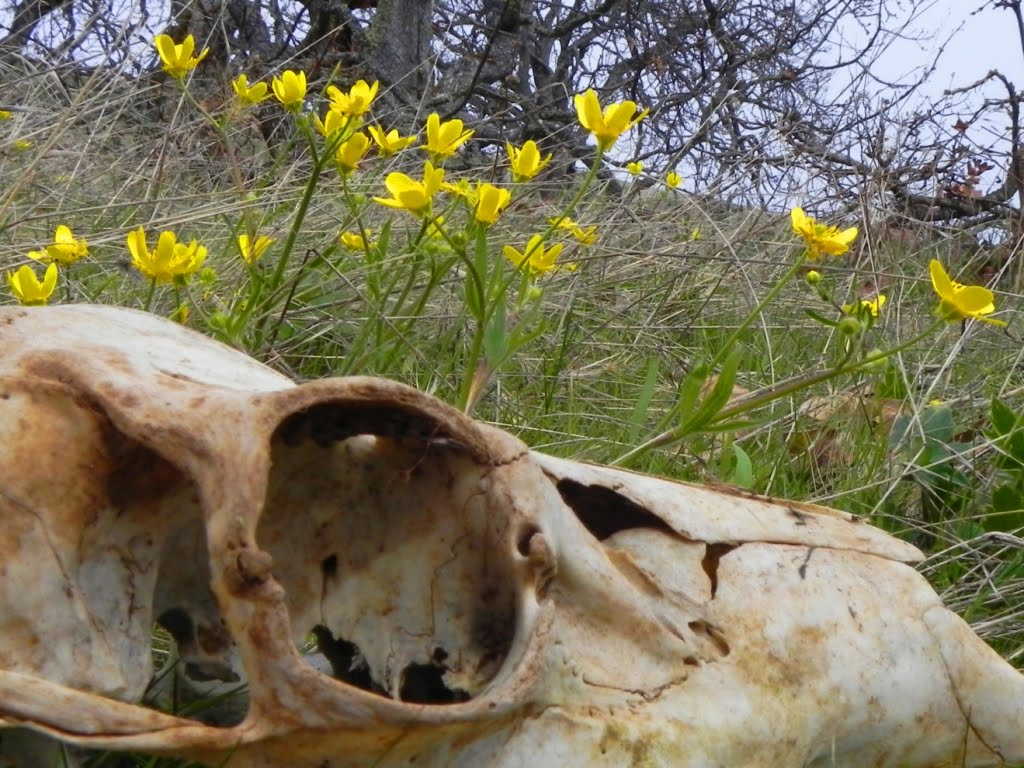
I hiked past the bathtub and past the deer-kill I found last March. Not much remains but a skull in the flowers, a segment of vertebra with thick green grass outlining white bone. Hard to believe anything is left of it.


No deer, but sign everywhere: tracks, droppings, paths made for hoofs in the moss and stone. I haven’t been in the right place to see them, I guess, but it’s a warm day and only 6pm. Time yet. Grass widows are mostly gone but other flowers have taken their place. Buttercups are everywhere, alongside oaks toothwort and blue-eyed mary in the duff. There are shooting stars in the hundreds by the Dharma tree, and a carpet of glacier lily in the gully above the arch Yellow and purple desert parsley turn basalt crags and gnarled solitary oak into refined oriental gardens. Hound’s-tooth attracts bees and saxifrage fills the lower meadows, while lupine is everywhere about to bloom, and deep green bitterroot leaves are waiting. A few balsamroot brighten the cliffs.

After saying hello to some hikers near the arch, I didn’t speak again until almost back at the creek crossing several hours later, when I told a circling bee that “I am not a flower.”

Things are drying out and the oaks are beginning to bud. Everything is stirring. Up on Tracey Hill, coyote scat – gray, filled with hair and fragments of bone – lines the trail between labyrinths of gopher tunnels and dirt upturned into patterns like gopher writing.

Another change: above the corral, the ponderosa limb with that unusual growth has died and fallen; no sign of the growth left among the limbs and twigs in the grass. The tree looks healthy.
Almost to the end of this journal. Almost two years… Started at Crater Lake in 2010. Looking back makes me wish I’d written more. It also makes me realize how many miles I’ve traveled, how much I’ve seen, how much there is to come.

Mallards zip by overhead, a pair. Just a chuckle in greeting and they’re gone over the river. A good day for birds.

When I saw the harrier, it was because I felt I should turn around at that exact moment. It was different from stopping to catch my breath, or to look at the view. Irrational, but knowledge nonetheless. How much goes on behind me, when I’m not looking?

My thoughts have ranged up and down these trails with no order. But a natural order, a wild order. It’s a good day to sign off in this volume and move on to the next, with more looking behind and more looking ahead: next weekend, wherever it finds me. But first the drive home, a tick-check and shower, a beer and music while I look through the photos I’ve taken.

I’ll bet none of those photos will do today justice. None of them will last like that harrier on the wing.

Finis.

Saturday, April 14, 2012

The Calendar Explained: February

Taken November 15th, 2011. Camera; Nikon CoolPix P100.
f/5.6, exposure time 1/278 sec., ISO 160, exposure bias -1, focal length 76mm, aperture 3

1.

I posted this image online shortly after I took it, and even after cropping and adjusting for its rougher qualities, I still like it. Sunset comes early in November, and despite the pink sky and sunlight glinting in the waves, there was tension flowing through the day. The tide was high and the breakers at sunset thundered against the rocks. Terrible Tilly hovered above a heaving sea, with seagulls and light filling the space between. I remember actually feeling and hearing waves break against the rocks and reverberate through the ground. It felt like any minute the sea would reach in and sweep away the few people on the beach, myself included. As a hiker I love days like this, when nature presents such an impressive and unending emotive and thought-provoking display. The juxtaposition of sea and stone, light and space, and tension and release made for a memorable day, and that hopefully shows in this photograph.

2.

I’ve always loved that Dizzy Gillespie said “I don’t care much about music. What I like is sounds.” His words hold true when translated to any artistic medium, including photography.

Like writing, photography is a method of re-creating experience. A good photograph will do that better than a snapshot, and the way to get a good photograph is to be in the right place at the right time, and to be looking the right way.

This photograph, I remember, didn’t take much effort at all. That’s not actually an arrogant statement. I drove to the coast and walked down the beach. I made myself comfortable and stayed on the beach for hours. I slowed down and grew attuned to what was going on around me. In other words, I did the work and was looking the right way. I only needed to see the photograph before I took it.

I’m sometimes guilty of letting the camera dictate what I see. Before I took this photograph, I spent a long time taking photographs of waves crashing against rocks and splashing high in the air. That time might have been better spent just watching.

Truth be told, I took 250 photographs before this one, and my camera battery was almost dead. When I finally stopped taking so many pictures, my experiences became richer. It took the absence of photography to get this photograph. And after taking it, I only took nine more.

That entire day, I didn’t get a single photograph I liked as much as this one. 

Friday, April 6, 2012

The Calendar Explained: January

Towards the end of 2011, I put together a calendar for a small number of friends and family. One of them hangs above my desk at work, and recently I flipped the page to April and decided to write about each photograph and the story behind it. This is the first of those stories.

Taken January 4th, 2011. Camera: Canon PowerShot A480
f/3, exposure 1/160 sec., ISO 125, focal length 7 mm, aperture 3.15625
Timing is everything with winter hiking, and I’ve been fairly successful at getting out in January to see the Columbia River Gorge’s frozen waterfalls. It takes a set of cold, dry weather and some traction devices for your feet, but it’s worth it to drive along the old highway and stop at ice-coated falls such as Horsetail and Ponytail, Oneonta and Latourelle. Other falls may be more impressive, but the lower tier of Multnomah Falls under the Benson Bridge has an understated quality. Partly this is because the main drop on Multnomah is so huge, falling hundreds of feet down basalt cliffs spackled with patterns of frozen water. Partly it’s because the main splash pool just above the lower falls is coated with ice inches thick, and freezing spray turns the Benson Bridge into a skating rink. When I took this photo, there was so much ice on the bridge it was closed, and the upper pool was a monochrome definition of winter: black stone, white ice, and bitterly cold wind and spray. The lower pool, however, wore a more delicate, less severe mood, with bright green moss and winter fern adding warmth and contrast to the cool ice and blue water. The patterns of ice were accents, not the main theme, like a piano solo in the middle of a brassy jam: less abstract and elemental, they invited contemplation. Water still poured over the falls and winter still held the water in its grip, but there was melody in the rocky foliage and a note of passage. This photo scarcely captures that, but of all the falls and all the photos I took, this is the one that stands out to me emotionally, although I’m certain that quality is only evident if you’d been there.
 

Thursday, March 15, 2012

Mountains Walking

If you doubt mountains walking you do not know your own walking.

Dōgen, Mountains and Waters Sutra

In February I was in a head-space filled with moss and mud that sucked at my ambition. Better the real thing, I thought, so I went to Cape Falcon, where rain whipped over cliffs and the sea foamed and thundered in rocky coves. By the time I reached the tip of the cape, my pants were soaked and stained with mud to the knees. My hands were cold and my glasses misted with salt, and gray clouds hung over the beach and nearby Neahkanie Mountain. Out there, it looked and felt like the Pacific Northwest is supposed to – a rain-battered rugged coast dark with misty forests, swept by a steady wind and the occasional cry of a gull. Imagine a Chinese landscape scroll, with a solitary figure in the corner – laughably small, but necessary.
I almost didn’t go - bleak weather, laziness, and so on - but by early afternoon I was lacing my boots at the trailhead. Fifty yards later, the forest swallowed the noise of traffic, and I began to hear thousands of drops of water. Rain fell gently through the trees, splashed against leaves and spruce needles, dripped from glossy salal, and gurgled in flowing puddles. Dense, moody, and a hundred shades of green, the old-growth trapped the air and hushed sound. Mushrooms and ferns grew in the shade of sitka spruce eight feet in diameter, and old-man’s beard hung from colonnades of young trees rooted in decayed nurse logs. Time means little in these pockets of coastal forest, which seem endless and ancient and unhurried. The air is rich with loam and hummus, a heady conifer scent, and the salt of the ocean breeze. Even in daylight there are places where it stays dim, and February clouds only accentuate the atmospherics. Where the forest opens up, the light becomes voluptuous: moss and lichen cover everything in a soft carpet of green, and the light appears from everywhere at once, silvery and shadowless.
Eventually the forest opened onto a headland covered with dense thickets of salal and studded with wind-warped pine and spruce. Tunneling through wet brush to viewpoints on the south side of the cape, I looked south to Nehalem Spit and towards the ancient vision sites on the cloudy summit of Neakhanie Mountain, and ate lunch beneath a bonsai-shaped spruce above a steep cove. For an hour, I watched ocean swells slowly moving towards land, rising in sea-green waves that curled and exploded on a black gravel beach. Gulls drifted over the spray, and reddish-brown sea-weed drifted like bruises beneath the waves. Twice, more than a mile offshore, a puff of white and a dark comma of black showed where gray whales were feeding – year-long residents, maybe, or following their whale-roads north or south.
By this point I’d become so wet that I simply decided to stay wet, and wandered out towards the tip of the cape, trying to keep my camera dry and staying warm by moving. I came around a corner and encountered another hiker with his back to me, dancing slowly and grooving to headphones under a hood.

I said hello and he didn’t hear me. I tried again to get his attention, but couldn’t. This was getting awkward, and annoying – this guy was stationed exactly where I wanted to be, at the best, most remote viewpoint on the entire cape. I backed off and approached one more time, finally getting his attention. After a polite exchange I passed him, but came back quickly from the steep, slick, exposed trail at the end of the cape. When I returned he offered me a smoke, and so for the next half-hour we talked about things common to people who meet in February rain at the end of a cape jutting into the Pacific Ocean. I told him about seeing whales, and we talked about the migratory habits of grays. He pointed out bald eagles on a distant cliff, and I recommended he visit the Klickitat River to see their winter nesting grounds. We talked about mushroom hunting and rumors of Spanish gold on Neahkanie. We talked about Native Americans and Chinook Jargon, smallpox and Lewis and Clark, John Jacob Astor. And of course, we talked about hiking.

In Portland, if I’d passed this guy on the street, I probably wouldn’t even look at him. And he wouldn’t look at me. But just the fact of being out on the cape meant we had something in common, had something to talk about. We both get it.
My initial annoyance with this interuption of solitude had turned to enjoyment of the conversation we shared. Solitude while hiking is a wonderful thing, but it’s not the only thing. We can’t truly “get away” in nature without losing ourselves. We carry our selves into wilderness, and wildness includes other people, actually can’t exist without people – not because we define its boundaries semantically or on a map, but because nature necessarily includes us. Most of us are simply too far removed to even be aware we’re removed. But the rain that falls in Portland is the same rain that falls on Cape Falcon. And the wild forests I walk in at Cape Falcon are just as wild and real and vital as those in my mind when I walk garbage out to the dumpster by my home in the city. That’s what Dōgen was getting at, and what Gary Snyder meant when he said “To know the spirit of a place is to realize that you are part of a part and that the whole is made of parts, each of which is whole. You start with the part you are whole in.”
Before I left the end of the cape, I took one long last look at the sea crashing against the cliffs. Low clouds drifted among the shore-pine and spruce, and swells rolled in towards Short Sands beach and surfers in the scroll of waves. A gull flew overhead, and I heard in the wind the sound of it laughing.

Wednesday, March 7, 2012

Wildlife Sightings

“If one is patient,” he said, “if one is careful, I think there is probably nothing that cannot be retrieved.”


Barry Lopez, The Orrery


The crowds dismay me as soon as I arrive at the Multnomah Falls trailhead. It shouldn’t be a surprise how many people are here on a very nice Sunday in early March. But I haven’t been on a solid hike with a bunch of elevation and distance since last October, and a lot of my favorite trails need extensive maintenance to open, or are too deeply covered in snow. So I pass through frustrating groups of tourists sipping coffee and taking photos, cross the narrow Benson Bridge, “put on the afterburners” and climb past day trippers, slow hikers, families with strollers and babies on their backs, running kids, and leash-less dogs. At last I reach the top of the falls and the paved trail turns to rock and earth, thinning the crowds. I can finally catch my breath.


A mile later, at the intersection with the Wahkeena trail, a sign says the bridge further up on the Larch Mountain trail is damaged and unsafe. I walk up to look. A couple in their 50’s is on the other side, dressed in rain-pants and knee-high gaiters, with snowshoes strapped to their packs. “Crossed it six times since they closed it,” says the man after he strides across. “You’ll find snow on Devil’s Rest.”


I stop for a break at the top of the Wahkeena trail. Two trails drop down to Wahkeena Canyon, one heads west to Angel’s Rest, and a third climbs up to Devil’s Rest. I look up into the trees – tall second-growth doug fir, old branches draped in moss, crowns of deep green needles against a clear blue sky. A shadow sweeps by – a crow chases another in and out of the canopy, darting around trees in a game of tag, cawing in the forest.


I don’t prefer blonds, but the one with her friends a little distance away is unbelievably stunning, with rosy cheeks and a contagious smile, in her mid-twenties, and wearing hiking clothes that excite my imagination. It is not too early in the season to find flowers in the wilderness. She and her friends hike on, leaving no trace.


Below Devil’s Rest, I put yaktracks on my boots for extra traction. An older woman descends the trail and stops to chat. She tells me the trail ahead is filled with snow, and beautiful. She recently had surgery, but since her recovery, she's has hit the trail every weekend. She says her doctor probably wouldn’t agree with her climbing to Devil’s Rest, but she can’t help it. I’ve been in her position, and we part with mutual words of encouragement.

In the snow, just before the summit, a man in a t-shirt and ear-buds asks where the overlook is. He seems lost, but competent. I send him down the trail a half mile. Another man passes me, dressed to climb Hood. He’s almost running down the trail in crampons. He’s Japanese, speaks broken English, and seems lost in his own good way.


Finally at the summit, I take off my pack and pour green tea. There’s no view, just a jumble of mossy green boulders in the sun. Movement catches my eye: a large crow glides past at eye level, and with a single caw and a flap of its wings, it disappears into the trees. Voices rise up from the trail below.


It’s a very fit man with a bushy moustache. His daughter follows him to the summit. “Here we are,” he says. “Now you’ve seen it.” They stay a few moments, and depart.


Next come two women with a black lab and two whippets. One of the whippets whimpers with cold. A young man follows close behind. He has a GPS and seems to be the hike leader, a loose designation because all three hikers seem to be exploring the network of trails around here without definite plans. One of the women asks Jason for the time; I look at my watch and almost answer. Then, laughing at myself, I pack up my thermos and put on my pack.


I don’t take more than a few steps when two trail runners arrive in shorts and light windbreakers, carrying water bottles in their hands. They stay just a minute before running off. Damn them. I struggled to get up here and they’re running ahead of me, hooting in the trees.


I take the Foxglove trail, a user-maintained path leading west and down from the summit of Devil’s Rest. It joins the Angel’s Rest trail going back to Wahkeena. Suddenly, there are two familiar faces, a younger couple dressed in t-shirts. I’d seen them on the way to Devil’s Rest, and remarked how great it felt to be able to hike in t-shirts. They happily agreed then, but they don’t look happy now. The man just looks tired, but the woman looks cold and frustrated. Without thinking, I say “Haven’t I seen you before?” They don’t respond, and I spend the next half-mile thinking how creepy that comment may have sounded. In the end, I decide it doesn’t matter.


Once on the Angel’s Rest trail, the snow thins and disappears. I stop a few times to take pictures, and a young woman overtakes me by Wahkeena Spring. When I say hello, she smiles shyly back, and continues on. I let her get ahead and keep hiking, but soon she and I are in an unspoken race to stay ahead of a large group of loud, ill-equipped hikers carrying lap-dogs in their arms as they descend the steep, muddy Wahkeena trail.


I’m getting hungry now. I haven’t eaten lunch, and in my haste to avoid others, I’ve passed by several good lunch spots. But I’m almost back to the trailhead. Just as the canyon narrows to allow only a steep trail alongside a falling white-water creek, I pass two overweight women struggling uphill. I can see by their gear and their faces that they’re determined and serious. I say hello and one of them beams a giant smile at me. It wins the smile of the day, for sure – this is their trail too, and I like seeing them enjoy it in spite of, or maybe because of, the challenge it presents to them.


I’m giddy but tired while walking through the crowded old highway parking lot at Multnomah Falls. An elderly woman in a group walks right at me, not moving out of the way at all. I step aside, right up against a line of parked cars. The woman continues forward. My trekking poles are stashed horizontally across my pack, and the tip is at this woman’s eye level. I can’t move out of the way, and she won’t move, so I give up. The sharp tip of the trekking pole misses her eye by about two inches.


Back in the main parking lot, I walk past a bunch of bikers clad in leather standing around their Harleys, and I watch kids playing Frisbee in the grass. I feel great – sore, but in a good way, and peacefully energized. Pouring coffee from a thermos, I take off my boots and socks and join everyone else in enjoying the late afternoon sun. Devil’s Rest is out of sight above the steep, thousand-foot cliffs, and Multnomah Falls is in shadow. One of the bikers starts his engine and the rumble sets off the car alarm in the Subaru next to me. Then a crow flies overhead, cawing in the clear blue sky.